Безплатна доставка със Speedy над 129 лв
Box Now 9 лв Speedy office 11 лв Speedy 13 лв ЕКОНТ 6 лв Еконтомат/Офис на Еконт 6 лв

Floodplain Delineation Using GIS Based River Analysis System

Език Английски езикАнглийски език
Книга С меки корици
Книга Floodplain Delineation Using GIS Based River Analysis System Muhammad Latif
Код Либристо: 06832825
Издателство VDM Verlag, април 2010
Floodplain is an area adjacent to the main river channel and is very fertile to agriculture; therefo... Цялото описание
? points 161 b
127 лв
Външен склад Изпращаме след 14-18 дни

30 дни за връщане на стоката


Може би ще Ви заинтересува


TOP
Yoga Anatomy Amy Matthews / С меки корици
common.buy 50 лв
TOP
Soccermatics David Sumpter / С меки корици
common.buy 30 лв
TOP
English Grammar in Use Supplementary Exercises Book with Answers Louise Hashemi / С меки корици
common.buy 38 лв
TOP
Color Theory (Artist's Library) Patti Mollica / С меки корици
common.buy 22 лв
Eastern Blocks Zupagrafika / С твърди корици
common.buy 46 лв
Lonely Planet Jordan Paul Clammer / С меки корици
common.buy 42 лв
High-Performance Training for Sports David Joyce / С меки корици
common.buy 113 лв
Vintage Commodore 128 Personal Computer Handbook: 2019 Survival Edition Margaret Gorts Morabito / С меки корици
common.buy 37 лв
XX Brain / С меки корици
common.buy 29 лв
Vanishing Half / С меки корици
common.buy 44 лв
Significance: A Significance Series Novel Shelly Crane / С меки корици
common.buy 35 лв
Future Was Here Jimmy Maher / С меки корици
common.buy 114 лв
Into Wild Mongolia George B. Schaller / С твърди корици
common.buy 63 лв
Wildlife of the Tibetan Steppe George B. Schaller / С меки корици
common.buy 106 лв

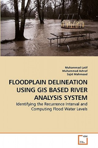
Floodplain is an area adjacent to the main river channel and is very fertile to agriculture; therefore, these areas have been widely developed for agriculture and settlement purposes. As a result, floods have caused enormous damages to life, property and agriculture many times in the past. The river Indus doesn t flow in a single main channel. At some places it is divided into two channels and water flows even in the low flow season. Consequently, the areas in between these channels have also been developed for agriculture. In the present study, frequency analysis results show the recurrence interval of up to 500 years return period by using the Normal, Log-Pearson Type III and the Extreme Gumble s Distributions and hydraulic model results from the geometric data extracted from the Digital Elevation Model (DEM) of 90 and 30 meter resolution are presented in this technical book chapter wise.The authors appreciate the efforts of Barthlemy Chaton and his team in facilitating during book finalization and highly acknowledge publishing of this book by VDM Publishing House Ltd., for technical knowledge sharing internationally.

Информация за книгата

Пълно заглавие Floodplain Delineation Using GIS Based River Analysis System
Език Английски език
Корици Книга - С меки корици
Дата на издаване 2010
Брой страници 84
Баркод 9783639253498
ISBN 3639253493
Код Либристо 06832825
Издателство VDM Verlag
Тегло 136
Размери 152 x 229 x 5
Подарете тази книга днес
Лесно е
1 Добавете книгата в количката си и изберете Доставка като подарък 2 В замяна ще ви изпратим ваучер 3 Книгата ще пристигне на адреса на получателя

Вход

Влезте в акаунта си. Още нямате акаунт за Libristo? Създайте го сега!

 
задължително
задължително

Нямате акаунт? Използвайте предимствата на акаунта за Libristo!

Благодарение на акаунта за Libristo държите всичко под контрол.

Създаване на акаунт за Libristo