
 Контакт
 Как се пазарува?
Доставка
Наръчник за пазаруване
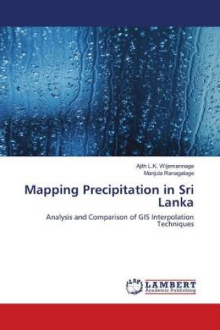
Mapping Precipitation in Sri Lanka
Analysis and Comparison of GIS Interpolation Techniques
 Английски език
 82 b
82 b
До 30 дни за връщане на стоки
Клиентите са закупили също

 /
/
 С меки корици
 27.25
€
53.30 лв
27.25
€
53.30 лв








 /
С меки корици
37.53
€
73.41 лв
/
С меки корици
37.53
€
73.41 лв

 /
С меки корици
15.47
€
30.26 лв
/
С меки корици
15.47
€
30.26 лв


 /
С меки корици
45.09
€
88.20 лв
/
С меки корици
45.09
€
88.20 лв


 /
С меки корици
9.87
€
19.30 лв
/
С меки корици
9.87
€
19.30 лв
 /
С меки корици
72.09
€
141.00 лв
/
С меки корици
72.09
€
141.00 лв


 /
С меки корици
74.90
€
146.49 лв
/
С меки корици
74.90
€
146.49 лв
 /
С меки корици
95.49
€
186.76 лв
/
С меки корици
95.49
€
186.76 лв


 /
С твърди корици
68.34
€
133.66 лв
/
С твърди корици
68.34
€
133.66 лв



Precipitation is a highly important and a key input for many hydrological and ecological models, including water resource management, recharge assessment, irrigation scheduling, vegetation, and crop production models. However, rainfall records are often incomplete due to the missing rainfall data in the measured period or insufficient stations in the study region. The spatial interpolation method is one of the most common technique, and it is frequently used to estimate values of meteorological parameters in locations where they are not measured or missing. The use of different interpolation schemes in the same catchment may cause significant differences and deviations from the actual spatial distribution of rainfall. It is needed to compare the performances of each interpolation method to get excellent interpolation technique. GIS is offering the vast rage range of statistical methods to interpolate precipitation based on data recorded at several irregularly spaced gauges. In this analysis, five methods were used to predict monthly precipitation, and each technique was compared.


Информация за книгата
Английски език

Подарете тази книга днес
Лесно е
1 Добавете книгата в количката си и изберете Доставка като подарък 2 В замяна ще ви изпратим ваучер 3 Книгата ще пристигне на адреса на получателяМоже би ще Ви заинтересува




 /
С меки корици
19.18
€
37.52 лв
/
С меки корици
19.18
€
37.52 лв
 /
С меки корици
11.72
€
22.92 лв
/
С меки корици
11.72
€
22.92 лв
















Здравейте! Аз съм Libroamiko, вашият книжен съветник.
Как мога да ви помогна?