
 Контакт
 Как се пазарува?

Доставка
Наръчник за пазаруване
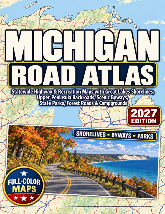
Michigan Road Atlas 2027
Statewide Highway & Recreation Maps with Great Lakes Shorelines, Upper Peninsula Backroads, Scenic Byways, State Parks, Forest Roads & Campgrounds
 Английски език
 72 b
 Подготвяме
 Нови
До 30 дни за връщане на стоки

STATEWIDE MICHIGAN ROAD MAP
110 Detailed Road Maps. All 83 Michigan Counties. Both Peninsulas, Mapped in Full Color.
From Detroit's interstate network to the remote backroads of the Upper Peninsula, Michigan Road Atlas 2027 brings the state's highways, county roads, small towns, Great Lakes shorelines, and recreation areas together in one printed atlas.
The 110 detailed road maps use two practical scales: 1:200,000 across southern Lower Michigan and 1:250,000 across northern Lower Michigan and the Upper Peninsula. Overlapping map sheets, road-number markers, continuation references, and a page-and-grid index help you follow routes from one region to the next.
Whether you're crossing the Mackinac Bridge, driving along Lake Michigan, exploring forest roads near Lake Superior, or finding a campground away from the main highways, this atlas puts the road network and surrounding geography in view.
What's Inside Michigan Road Atlas 2027110 Detailed Statewide Road Maps: Full coverage of all 83 Michigan counties, with Interstate highways, U.S. routes, M-routes, county roads, rural backroads, paved and gravel roads, signed exits, and connections between neighboring map pages.
Upper Peninsula and Forest Road Coverage: Detailed routes through the Keweenaw Peninsula, Copper Country, Marquette, Munising, and northern forest regions. Includes mapped forest roads in the Hiawatha and Ottawa National Forests and the Huron-Manistee National Forests of the Lower Peninsula, with road-surface and seasonal-access information where verified.
22 Designated Michigan Byways: Scenic, recreational, and historic routes including M-22, the M-119 Tunnel of Trees, US-2 Top of the Lake, US-41 Copper Country Trail, M-123 Tahquamenon, and the US-23 Sunrise Coast. A byway directory helps locate each route on the maps.
Great Lakes Shorelines and Island Connections: Road maps along Lakes Michigan, Superior, Huron, and Erie, with shoreline communities, major bridges, vehicle-ferry connections, passenger ferry departures, and international border crossings.
City, Metro and Regional Maps: Five regional highway maps, Upper and Lower Peninsula overviews, and 16 pages of enlarged city and metro mapping covering Detroit, Grand Rapids, Lansing, Ann Arbor, Flint, Kalamazoo, Traverse City, Marquette, Sault Ste. Marie, and other important road centers.
20 Special Road and Recreation Maps: Additional coverage of Sleeping Bear Dunes, Pictured Rocks, the Straits of Mackinac, the Keweenaw Peninsula, Tahquamenon Falls, the Porcupine Mountains, and other notable shoreline, byway, and park-access areas.
State Parks, Campgrounds and Forest Recreation: Mapped park entrances, public campgrounds, recreation areas, rest areas, roadside parks, and selected fuel stops, supported by reference directories with page-and-grid locations.
Driving Distances and an Alphabetical Index: A mileage and driving-time reference for 18 Michigan cities, plus 3,649 indexed places, including communities, parks, lakes, islands, counties, and landmarks.
The maps use recognizable highway shields, differentiated road types, route numbers, map-grid references, and adjoining-page indicators to help you locate places and follow roads across Michigan.
Michigan Road Atlas 2027 is designed for residents, road travelers, campers, RV drivers, and anyone who wants a detailed printed view of Michigan's road network and outdoor destinations.
From the Great Lakes shoreline to the Upper Peninsula's forest roads, see more of Michigan on every map.


Информация за книгата
Английски език

Подарете тази книга днес
Лесно е
1 Добавете книгата в количката си и изберете Доставка като подарък 2 В замяна ще ви изпратим ваучер 3 Книгата ще пристигне на адреса на получателяЗдравейте! Аз съм Libroamiko, вашият книжен съветник.
Как мога да ви помогна?